Wildfire Prediction System
Is there a system that can say with certainty at what time and on what day a wildfire will occur deep in a forest?
A wildfire prediction system is a system that uses data-driven models, geographic information, weather data, and fire behavior models to identify the probability of fire occurrence, the level of risk, areas that are prone to wildfire, or the potential path of fire spread.
Therefore, the answer to the first question is no! There is no system that can say a wildfire will occur at this exact location tomorrow at 12:00. These systems do not work like Nostradamus, and such a claim is not scientifically defensible.
Fire behavior depends on many variables, and some of them, such as a sudden ignition source or a rapid change in wind, cannot be predicted precisely.
Newer systems, instead of relying on a single indicator, combine multiple types of data, such as temperature, humidity, wind, fuel moisture, vegetation, topography, fire history, satellite data, and human activity. Recent research has even moved toward models that combine real-time data with physical fire behavior models and artificial intelligence.
In this article, on the SenseNet website, we will discuss how fire prediction works and what its limitations are. If you are curious about this topic, keep scrolling.
What Exactly Does a Wildfire Prediction System Predict?
Before examining the technology, we need to clarify what is meant by “wildfire prediction.” This term usually refers to several different types of prediction.
1. Predicting the Probability of Fire Occurrence
In this case, the system examines which areas have more favorable conditions for fire ignition within a specific period of time.
For example, if an area is experiencing higher temperatures, lower humidity, drying vegetation, and strong winds at the same time, the model can identify that area as a higher-risk zone.
This type of prediction is mainly used for preparedness, resource allocation, mobilization, and resource management.
One recent example of this approach is AI-based models that consider not only weather conditions, but also vegetation status and human factors. Recent research has shown that adding these variables can provide a more accurate picture of risk compared with relying solely on historical data or traditional indices.
2. Predicting Fire Behavior and Spread
After a fire starts, another question arises:
If a fire starts at this location, which direction will it move in the coming hours?
This is where the focus shifts from “probability of occurrence” to Fire Spread Prediction, or predicting fire spread.
The model needs to consider factors such as:
- Wind speed and direction
- Terrain slope
- Type and density of vegetation
- Fuel moisture
- Weather conditions
- Current shape and location of the fire
- Topographical characteristics
This information can be used to predict the potential path of the fire, estimate when the fire may reach specific areas, and support decisions about resource deployment or evacuation.
3. Predicting Fire Intensity
Not all fires behave in the same way.
An advanced prediction system should be able to provide information not only about the potential location of a fire, but also about its intensity and potential for spread.
This is important for emergency managers because the distance between a fire and an infrastructure asset alone does not determine how dangerous that fire is. Wind speed, available fuel, and terrain conditions can change the situation within a short period of time.
4. Short-Term Prediction
Newer models are moving toward predictions that are close to real time.
In a study published in 2025, an Edge Computing-based system was designed to simulate fire spread. Its goal was to perform high-resolution predictions in remote areas, even with limited computational resources. In the study’s experiments, the model was able to simulate fire spread up to five hours ahead within a few minutes.
This direction is important because in emergency situations, it is not always possible to send data to a powerful processing center.
How Does a Wildfire Prediction System Work?
A real prediction system usually consists of several layers of data and models.
Weather Data
Weather is one of the most important variables determining fire behavior.
The system can receive information such as:
- Air temperature
- Wind speed and direction
- Relative humidity
- Precipitation
- Atmospheric dryness
- Vapor Pressure Deficit or VPD
- Hourly changes in weather conditions
Vegetation and Fuel Data
Fire does not depend on weather alone.
The amount and type of combustible material available in an area are important inputs for prediction models.
For example, a dry area with dense vegetation and a dry area with sparse vegetation do not necessarily behave in the same way when exposed to fire.
In 2025, UCLA researchers introduced FuelVision, a tool that combines satellite imagery and artificial intelligence to produce maps of combustible fuel. In tests using data from the Dixie and Caldor fires in California, the system was able to produce maps that closely represented the actual fuel conditions in the area.
This highlights an important point:
Fire prediction without understanding the actual condition of the fuel does not give the model a complete picture of the environment.
The Role of Topography in Wildfire Prediction
Terrain is not just a background map.
Slope, elevation, aspect, and terrain shape can change fire behavior. A fire on a slope can behave differently from one on flat ground, and wind in mountainous areas can also be affected by the shape of the terrain.
For this reason, newer systems also incorporate geographic data into their models.
For example, a 2026 study on fire prediction models emphasized that combining data on fuel, weather, and topography is important for more reliable prediction of fire behavior.
What Does AI Do in a Wildfire Prediction System?
Artificial intelligence is not meant to replace the physical laws governing fire.
Its main purpose is to extract patterns from large volumes of data that can be difficult or time-consuming to analyze using traditional methods.
An AI system can analyze data such as:
Weather + Vegetation + Topography + Historical Fire Data + Satellite Data + Real-Time Observations
and generate outputs such as the probability of fire occurrence or potential fire spread scenarios.
In a study published in 2025, a Transformer model was combined with Sentinel, ERA5, and SRTM data. A Fuzzy Logic system was then used to convert the model’s output into interpretable decision-making rules. In the study’s evaluation, the model achieved an F1 score of 92.9 percent and an Accuracy of 94.8 percent.
But there is an important point:
The accuracy of a model in a laboratory setting alone does not mean that it is reliable for real-world operations.
The model needs to be evaluated under real-world conditions, across different regions, different seasons, and with data it has not previously encountered.
This issue has become an important topic in recent research because wildfire prediction models may achieve very good scores on one dataset but perform differently when transferred to a new geographic region.
Fortunately, one of the main areas of SenseNet’s work is evaluating system performance across new geographic areas and regions. If any disruption occurs in the system, a team of experts, engineers, and scientists will work to resolve it.
What Is the Difference Between Wildfire Prediction and Wildfire Detection?
This is one of the most important distinctions to consider when choosing a system.
Prediction asks:
Where and when is the probability of fire or rapid fire spread higher?
Wildfire detection asks:
Is there a fire happening right now?
These two technologies can complement each other.
Suppose a prediction model reports that an area will face highly dangerous conditions in the coming hours. This information can be used to increase monitoring or preparedness levels.
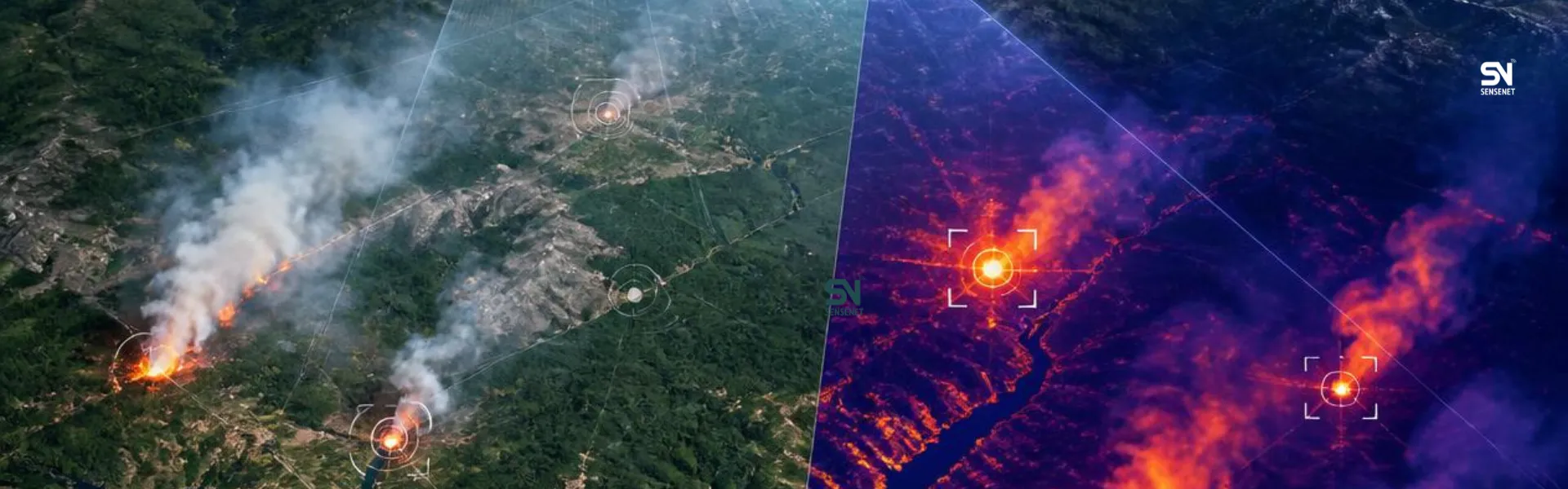
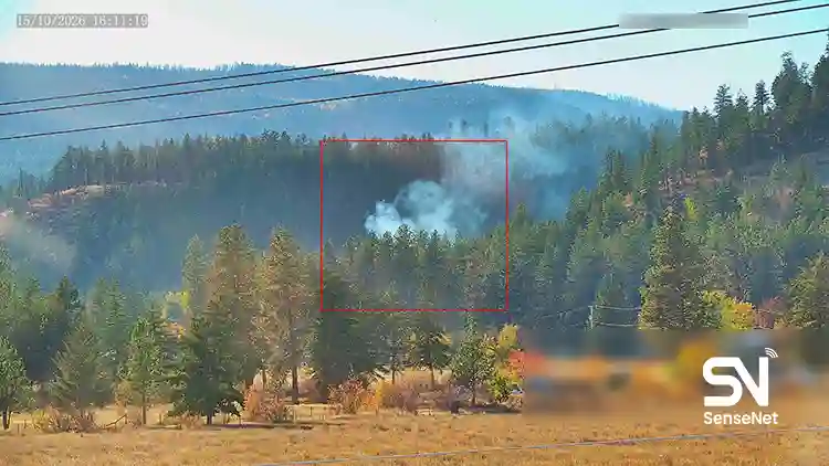
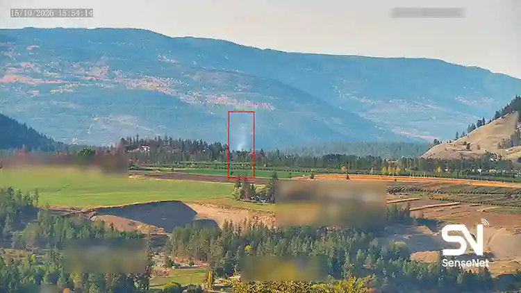
If a fire starts in the same area, an early detection system should be able to identify it.
In practice, operational value increases when prediction, observation, and detection are placed within a single information cycle.
What Data Does a Good Wildfire Prediction System Need?
The more accurately a system is expected to perform at an operational scale, the more different types of data it needs to combine correctly.
| Data Type | Application |
| Weather Data | Identifying weather conditions favorable to fire and predicting its behavior |
| Wind Data | Estimating the direction and speed of spread |
| Temperature | Assessing dryness and risk conditions |
| Humidity / VPD | Estimating environmental and fuel dryness |
| Vegetation Data | Determining the amount and type of fuel |
| Fuel Moisture | Assessing the flammability of vegetation |
| Topography | Analyzing the effect of slope and terrain shape |
| Satellite Imagery | Monitoring changes in the land surface and hot spots |
| Historical Fire Data | Training and validating the model |
| Human Activity Data | Estimating some potential sources of fire ignition |
| Real-Time Sensor Data | Updating the model based on current conditions |
| Fire Perimeter | Refining fire spread predictions after ignition |
In 2026, systems are even being developed that feed observed data back into the prediction cycle. A study published in Environmental Modelling & Software used a system that employed model predictions to guide UAVs and then fed the data collected by the drones back into the model to improve fire spread prediction. In that experiment, the error in predicting the fire environment was reduced by 53 percent.
This is what separates next-generation prediction systems from a static risk map.
Instead of making a prediction once and stopping there, the model is continuously updated with new information.
Can Wildfire Prediction Provide a Warning Before a Fire Occurs?
Yes, but a distinction must be made between “risk prediction” and “prediction of a specific fire.”
A system can use weather conditions, vegetation, terrain conditions, and fire history to identify areas that have a higher level of risk within a specific period of time.
But this does not mean that it can definitively predict the location of ignition.
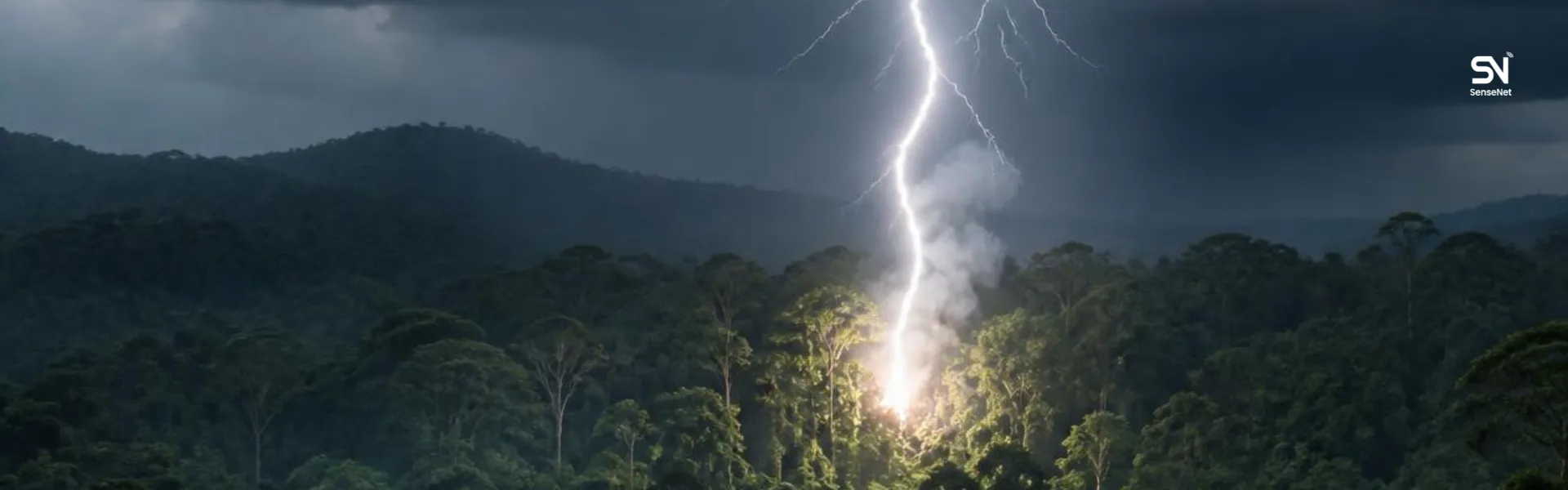
The factor that starts a fire may be lightning, equipment failure, human activity, or an unpredictable ignition source.
Therefore, the professional output of a system should look more like this:
“This area has a higher probability of risk over the next 24 hours.”
Not:
“A fire will occur at this exact location tomorrow at 2:30 PM.”
This difference may seem simple, but it is one of the most important criteria for distinguishing a scientific solution from a product that simply uses the phrase AI Prediction.
Real-World Experience: What Do Firefighters Want From Prediction?
One of the problems with prediction systems is that they can be highly sophisticated technically but fail to provide an output that is useful in the field.
This issue has also been raised in a specialized report on the use of GenAI in fire management.
Harrison Leahy, the leader of a BLM Hotshot team, explained in the report that one genuinely valuable application of modeling could be predicting how long it would take crews to reach a fire based on current conditions and estimating the size of the fire by the time they arrive.
This experience highlights a key point:
A firefighter does not need a beautiful map or a complicated number. They want to know if we make decision X right now, what conditions will the crews face when they reach the location?
Therefore, a good Wildfire Prediction System should translate its output into operational decision-making language.
The Experience of a Researcher With a Firefighting Background
Maggie Epstein, a Fire Science researcher at the University of Montana, previously worked with a wildland firefighting team in northern Idaho before entering research.
In 2025, she discussed the gap between research and firefighting operations and explained that decisions related to large wildfires have long been recorded in the Wildland Fire Decision Support System. These records include firefighters’ own explanations of operational decisions and the reasons behind them. She used a language model to analyze information related to 6,630 wildfires in the western United States.
This experience shows that valuable data for prediction is not limited to satellite and weather data.
Recorded human experience from actual operations can also be an important data source for building decision-support systems of the future.
Where Is Wildfire Prediction Heading in 2026?
The technology is moving from separate models toward connected, multilayered systems.
On one side are fire risk prediction models.
On the other are fire spread simulation models.
Alongside them are satellites, cameras, sensors, drones, and weather data.
Ultimately, all of this information needs to be converted into an operational decision.
Research in 2026 has even moved toward causal models and Graph Neural Networks to improve model transfer between different geographic regions, an issue that is particularly important for systems designed to operate in different environments.
At the same time, the USDA Forest Service is pursuing several practical AI applications in 2026, from modeling the relationship between temperature, wind turbulence, and fuel to estimating daily fire growth, optimizing aerial operations, and developing early warning systems.
This shows that the future of Wildfire Prediction is not limited to a single algorithm.
The main challenge is building a continuous information loop from the environment to the decision.
Is AI Alone Enough to Predict Wildfires?
No. This is one of the most important answers to consider when evaluating a system.
AI needs data.
If weather data is not accurate, if the fuel map is outdated, if topography has not been properly incorporated into the model, or if the model has not been trained and validated in the target region, even a highly advanced algorithm cannot produce a reliable result.
Recent research also emphasizes this issue. One 2025 study showed that general-purpose LLM-based models are not reliable for quantitative prediction of fire behavior, and that specialized models trained on dedicated fire data are more suitable for these applications.
Therefore, if a product simply says:
“We use AI to predict wildfires.”
That alone does not provide much information about the quality of the system.
The more important questions are:
- What data does the model use?
- How frequently is the data updated?
- In which regions has the model been validated?
- How is prediction uncertainty displayed?
- Is the model updated with real-world data from actual fire events?
- Is the output useful for operational decision-making?
- Can the system also be used in remote areas with limited infrastructure?
Features of a Professional Wildfire Prediction System
If a government organization, infrastructure company, forest manager, or emergency management team is planning to select a Wildfire Prediction System, it is better to examine these criteria rather than comparing products based solely on phrases such as AI-powered or next-generation.
Multilayer Prediction
The system should not provide only a single risk indicator. Ideally, it should be able to assess the risk of occurrence, potential intensity, and fire behavior if a fire starts.
Up-to-Date Data
Fire prediction has limited value when based on outdated information. Wind conditions, humidity, and fuel conditions can change within a short period of time.
Appropriate Spatial Resolution
A warning covering a very large area may not be sufficient for operational decision-making. The system should identify exactly where the risk is concentrated.
Continuous Updating
A prediction should not be a fixed output. As new data comes in, the model should be able to revise its scenario.
Displaying Uncertainty
A reliable system should not pretend that it knows the future with certainty. Displaying probability and the range of uncertainty allows decision-makers to assess risk more effectively.
Connection to Real-World Data
One of the most important advantages of next-generation systems is the simultaneous use of prediction and observation.
In other words, the model should not simply guess the future. When new real-world information is received from satellites, drones, sensors, or cameras, it should use that information to revise its prediction.
Ability to Operate in Remote Areas
For many forested areas, the problem is not just the algorithm. Electricity, internet connectivity, and physical access are limited.
For this reason, recent research has moved toward Edge processing and models capable of performing part of their computation close to where the data is collected.
What Is the Most Important Advantage of a Wildfire Prediction System?
The real value of a prediction system is not that it produces a beautiful, colorful map.
Its value lies in creating more time for decision-making.
If the system can identify a high-risk area earlier, managers can move personnel and equipment before conditions become critical.
If a fire has already started, a spread model can help responders understand which areas are likely to be at risk in the coming hours.
And if prediction is combined with detection, the system can connect “conditions that are favorable for fire” with “an actual fire that has just started.”
This is the point at which prediction technology moves from an analytical tool to an operational tool for wildfire management.
What Is the Future of Wildfire Prediction Systems?
The next generation of Wildfire Prediction systems will probably not consist of a single model.
They will look more like an intelligent network of models and sensors that continuously work together:
Weather → Fuel → Terrain → Risk Prediction → Detection → Fire Behavior Model → Updated Forecast → Operational Decision
In such a structure, every new piece of data can change the prediction.
This approach can also be seen in recent research. For example, hybrid systems are being developed that place satellite data, sensors, and drones within a single prediction and observation cycle.
The ultimate goal is not for the system to claim that it knows the future with certainty.
The goal is to understand faster than a traditional system what is changing when conditions change, and what the potential consequences are.
For forested and remote areas, this difference can be extremely important because in a wildfire, the first few hours can make a major difference in the size of the fire and whether it remains controllable.
Conclusion
A modern Wildfire Prediction System is not designed to predict the future with certainty.
Its job is to combine environmental, weather, geographic, historical, and real-time data to identify the probability of risk and potential fire behavior scenarios earlier than traditional methods.
New technologies are moving toward systems that connect prediction, observation, and modeling. AI models can analyze complex patterns more quickly, physical fire behavior models can simulate the logic of fire spread, and real-world data from satellites, drones, sensors, or cameras can update predictions in real time.
But the most important measure of a system’s success is not the complexity of its algorithm.
A system becomes truly valuable when its prediction can give more decision-making time to the people responsible for protecting forests, infrastructure, natural resources, and human lives.
And to achieve this, fire prediction needs to be part of a larger system, one that can assess risk before a fire occurs, detect the start of a fire quickly, model its behavior, and continuously update its understanding of the fire as new information becomes available.